P Kamchatka sea trade port container terminal. Kamchatka seaport
Sea port Petropavlovsk-Kamchatsky- seaport of federal significance. It is the largest seaport of the Kamchatka Territory. The port of Petropavlovsk-Kamchatsky is located on the shore of the ice-free Avachinskaya Bay - the second largest natural bay in the world. This is an internal reservoir 24 kilometers long and 12 kilometers wide along the parallel, with an average depth of 18 meters and a maximum depth of 28 meters. The total surface area of the water surface exceeds 215 square kilometers. The port is in close proximity to international shipping lines, which pass at a distance of 150-200 nautical miles from the eastern coast of Kamchatka. This is the port closest to the Northern Sea Route, equipped with the necessary infrastructure.
The number of port employees as of January 1, 2016 was 158 people. Of these: managers - 39 people, specialists - 51 people, employees - 2 people, workers - 66 people. Average age port workers - 45 years old.
Located on the territory of the city of Petropavlovsk-Kamchatsky.
Encyclopedic YouTube
1 / 5
✪ MY KAMCHATKA (Episode 2) | Port of Petropavlovsk-Kamchatsky
✪ Kamchatka. Petropavlovsk-Kamchatsky. Port.
✪ Petropavlovsk Kamchatsky Walk through the center
✪ KAMCHATKA. Petropavlovsk - Kamchatsky. Embankment (AVCHD)
✪ 01/28. Petropavlovsk-Kamchatsky. Kamchatka. July 2010.
Subtitles
Story
Kamchatka. Avacha Bay
Russian pioneers first reached the shores of Avachinskaya Bay by land, moving from the western coast of Kamchatka. The first to enter it from the ocean was navigator Ivan Elagin on the boat "St. Gabriel" in June 1740. He chose a place on the shore of Niakina harbor and, to put it modern language, built an expeditionary base. In October of the same year, the packet boats "St. Peter" and "St. Paul" under the command of Vitus Bering and Alexei Chirikov entered Avachinskaya Bay and stayed for the winter.
From these events and under the name of the patron saints of packet boats, the oldest Russian port and city of Petropavlovsk-Kamchatsky on the Pacific Ocean traces its history.
Avachinskaya Bay provides berth for ships different types in any quantity and in this respect is one of the best harbors in the world.
Avachinskaya Bay and the Petropavlovsky Bucket actually allow year-round navigation, since they do not freeze or the ice thickness is small and ships can enter using ice-clad tugs or port-type icebreakers. The navigable depths of the fairways are quite sufficient for the passage of sea vessels with any draft.
Sea trade port
The Great was coming Patriotic War and in this difficult period for the country State Committee The USSR Defense Council adopted a resolution on the construction of a seaport in Petropavlovsk-Kamchatsky. October 23, 1943 People's Commissar of the USSR Marine Fleet P.P. Shirshov issued order No. 336 "On the organization of the Petropavlovsk-Kamchatsky sea trade port of the People's Commissariat of the USSR People's Commissariat of Marine Fleet". This date is the day the port was founded.
The port was built in record time. The very first capital berth, then No. 6, located on the eastern shore of Niakina harbor opposite Cape Signalny, on which a 100-ton portal derrick crane was installed, began to receive cargo already in April 1944. Berths No. 1, 2 and 3, located on the same side to the north, and warehouses came into operation one after another in the second half of 1944. The last to be reconstructed and brought to full condition were two berths, built in 1943. The commissioning of all six berths of the first stage was formalized in February 1945. This construction was unique not only in terms of timing, but also in quality. It is unlikely that this has been surpassed or repeated anywhere; however, such a need, in all likelihood, has not arisen anywhere.
Only at the very beginning of capital construction, the formation of the port territory was carried out by manual filling. As imported equipment arrives manual labor replaced by machines. We imported: Studebaker trucks, Caterpillar compressors, mobile power stations, portal cranes, pile drivers, Larsen sheet piling, cement and much more. 16 excavators worked at the hydraulic section different brands. Hydraulic work was mechanized even beyond modern levels. Lend-Lease demanded and ensured the construction of the port. But there was also domestic equipment at the construction site.
The Petropavlovsk sea trade port officially became a functioning enterprise in February 1945, however, the processing of defense and national economic cargo was carried out in the port already in 1944. The berths were still without a head, the cranes moved along temporary crane tracks, there was mud on the non-concrete berths and the port area, but the port was functioning.
Over the past period, since the port was put into operation, the port has been improved, its berth area has been enlarged, its warehouse area has been expanded, its mechanical equipment has been increased - new portal cranes have been put into operation, modern cargo warehouses have been built, the fleet of reloading mechanisms and vessels has been replenished port fleet.
In its activities, the port had to solve problems that other ports operating in more favorable conditions did not face.
Thus, until the 60s in Petropavlovok-Kamchatsky there was no single energy system. Each enterprise had its own dwarf power plants, and the housing stock was lit intermittently by a low-power city power plant. In 1948-49 A steam turbine power plant with a capacity of 1000 kW was built at Cape Signalny, and at the beginning of the 90s a new one was built, diesel power plant, the power of which was increased to 3000 kW. This fully satisfied the production needs of the port and the lighting of the departmental residential area.
Since 1951, housing construction in the port began intensively.
Since the late 50s, the seaport began processing cargo in packages and containers.
In 1963, a passenger marine terminal building was built in the port. This building is still the sea gate of Petropavlovsk-Kamchatsky.
In the 70s, berths No. 11 and 12 were built in the seaport, berth No. 10 was converted into a container terminal, a canteen, a forklift garage with a block of utility rooms, repair and mechanical workshops, a cargo area management building and a rigging warehouse, a garage and a building were built motor transport services of the seaport, an automatic telephone exchange, a sawmill and a health complex.
In 1980, after reconstruction, the length of berth No. 1 was increased by 100 m, and vertical bank protection was erected.
In the period from 1980 to 1985, the reconstruction of berths No. 2, 5, 6, 7 and 8 was carried out.
In July 1986, by order of the USSR Ministry of Maritime Fleet dated July 10, 1986 No. 117, the captains of the Kholm and Petropavlovsk-Kamchatsky sea trading ports were granted the right to issue all types of diplomas for the ranks of command personnel of sea vessels, and the forms of the pilot's receipt were also approved.
The maritime passenger service that existed between Petropavlovsk-Kamchatsky and Vladivostok was discontinued at the end of the 80s due to unprofitability. Only in the 90s, when the seaport of Petropavlovsk-Kamchatsky was opened for international traffic and visits by foreign citizens, the flow of passengers through the seaport began to grow due to an increase in the number of Russian and foreign tourists visiting Kamchatka. Cruise ships from the USA, Japan and other countries of the Asia-Pacific region began to call at the seaport.
In 1992, in accordance with Decree of the President of Russia dated July 1, 1992 No. 721, OJSC Petropavlovsk-Kamchatsky Commercial Sea Port was established on the basis of the property complex of the Petropavlovsk-Kamchatsky Commercial Sea Port.
In 1994, by order of the Department maritime transport The Ministry of Transport of Russia dated November 23, 1994 No. 71 was created government agency"Maritime Administration of the Port of Petropavlovsk-Kamchatsky."
In January 2000, the State Institution "MAP Petropavlovsk-Kamchatsky" approved Mandatory regulations in the maritime commercial port Petropavlovsk-Kamchatsky, which established the rules for ensuring security and order in the seaport of Petropavlovsk-Kamchatsky.
Territory and water area of the Port
Port Territory
The Port territory is located on the eastern and western shores of the Outer Harbor of Peter and Paul Bay. In the east, the border of the Port territory runs from the demarcation line of berth No. 4 of the Port and berth No. 8 of the Petropavlovsk-Kamchatsky Fishing Port (PKMRP) in a straight line to the north-eastern corner of the marine terminal building, then from the southern corner of the marine terminal building along the stone fence towards the Petrovskaya hill to its slope, at which the northern checkpoint (checkpoint) is located. Further from the northern checkpoint, the border follows the slope of the Petrovskaya hill to the south to administrative building Port Authority, then along the Port Authority building to the southern gate of the Port. From the southern gate of the Port, the border runs in a general direction to the west and south along the stone fence of the territory of the motor depot and flour mill, to the southern border of berth N12. In the west, the Port’s border runs along the slope of the Signalnaya hill from the southern end of berth N1 to the northern border of the port expeditionary fleet (PEF) berths.
Port water area
The Port's water area is the Outer Harbor of the Petropavlovsk Bay, bounded from the north by a straight line connecting the demarcation line of berth No. 4 of the Port and berth No. 8 of PKMRP, with the northern end of the PEF berths located on west bank Outer harbor. The southern border of the port runs along a straight line connecting the southern end of berth No. 12 on the eastern shore of the Outer Harbor with the southern end of berth No. 1 on Cape Signalny. The eastern border runs along the cordons of berths NN 4-12 of the Port, and western border runs along the cordons of the PEF berths from the southern end of berth No. 1 and further north to their northern end.
Freight turnover
In the first post-war year, 1946, the port processed 205.6 thousand tons of various national economic cargo. In 1950, cargo handling doubled, amounting to 443.5 thousand tons, and in 1953 the port processed 810 thousand tons. various cargoes. In 1956, the volume of cargo handling for the first time exceeded design capacity- one million tons.
During the period from 1966 to 1970, cargo handling increased by 46%. And in 1970, cargo handling exceeded two million tons. Cargo processing in the 80s / 85-89 / amounted to 3.5 - 3.9 million tons. And finally, the beginning of the 90s.
It is impossible not to note the sharply increasing level of mechanization of loading and unloading operations, which from 62.3% in 1956-60. reached almost 100% in the 90s. The port is perhaps the most highly mechanized enterprise in the region.
The volume of cargo turnover in 2015 amounted to 987.4 thousand tons (-13.9% compared to the same figure in 2014). Analysis shows that in last years The Port's cargo turnover remains at 1 million tons.
Cargo turnover at the port berths for 2005-2015
| 2000 | 2001 | 2002 | 2003 | 2004 | 2005 | 2006 | 2007 | 2008 | 2009 |
|---|---|---|---|---|---|---|---|---|---|
| 877 | 919 | 946 | 1010 | 1030 | |||||
| 2010 | 2011 | 2012 | 2013 | 2014 | 2015 | ||||
| 1162,7 | 1063,9 | 1208 | 1194,1 | 1146,9 | 987,4 |
Freight turnover structure
In 2015, the main cargo processed were large-capacity containers (the share of 20-foot containers (loaded and empty) in the total volume of cargo turnover was 33%, the share of 40-foot containers (loaded and empty) in the total volume of cargo turnover was 36%), and bulk coal. (7% of total cargo turnover), construction materials in bulk and in containers (7.9% of the total turnover), ore in big bags (5.3% of the total turnover). Specific gravity Container cargo in the total volume of cargo turnover still makes up the majority - 69%, the share of bulk cargo is 14%, the share of general cargo is 17% of the total volume of cargo turnover.
In the structure of cargo turnover by type of navigation, coastal cargo predominates, which is explained by the current market conditions. At the end of 2015, the cabotage component of the cargo turnover of PKMTP OJSC was 89.4%. The total volume of coastal cargo in physical terms amounted to 883.1 thousand tons (-115.2 thousand tons by 2014).
Structure of cargo turnover by type of navigation (2014-2015)
| Freight turnover by types of swimming |
year 2014 | 2015 | Deviation in relation to by 2014 |
|||
|---|---|---|---|---|---|---|
| thousand tons | %% | thousand tons | %% | thousand tons | %% | |
| Cabotage | 998,4 | 87,1 % | 883,1 | 89,4 % | -115,2 | 7,3 |
| Export | 23,2 | 2,0 % | 67,4 | 6,82 % | 44,1 | -1,6 |
| Import | 125,3 | 10,9 % | 36,9 | 3,7 % | -88,3 | -5,7 |
| Total | 1146,9 | 987,4 | -159,4 | |||
In 2015, the main share of cabotage cargo flow was accounted for by processing large-capacity containers and accounts for 76.3% of the total volume of coastal cargo. The share of bulk cargo is 12.6%, other cargo is 11.1%. The indicator of transshipment of imported cargo in 2015 compared to 2014 decreased by 88.4 thousand tons, the decrease occurred across the entire range of imported cargo traffic. Processing of export cargo increased by 44.2 thousand tons compared to the same period of the previous year (the increase occurred due to the resumed cargo flow of nickel ore in big bags).
Import cargo flow was distributed as follows: cargo in containers - 10.1%, cars and equipment - 0.2%, packaged construction cargo - 33.9%, bulk clinker - 35.2%, other cargo - 20.6%. In 2015, the leaders among importing countries were South Korea (bulk clinker) and China (building materials).
In 2015, 21.6% of the export cargo flow was scrap metal shipped to South Korea, ore in big bags (export to China) accounted for 77.9% of export cargo traffic, cargo in containers – 0.4%, other cargo – 0.1%.
Social politics
For decades, PKMTP OJSC has been focusing on Special attention to its employees, members of their families and veterans who left the port for a well-deserved rest in the region social policy. The enterprise constantly has a commission for regulating social and labor relations, as well as a commission for social and domestic issues, created in 2003. In the reporting year, 17 meetings of the commission were held, as a result of which financial assistance was provided to employees and pensioners of the port at total amount 716.19 thousand rubles.
In order to make full use of incentives and moral incentives for workers who have made the most significant contribution to production and economic activity enterprises that have achieved consistently high performance indicators, as well as developing a conscious and conscientious attitude to execution job responsibilities, port workers are included on the “Our Frontline Workers” Honor Board.
PKMTP OJSC has social programs that provide an additional social package for employees. Employees receive rewards for holidays, anniversaries, financial assistance, a one-time benefit upon retirement. In the reporting year, 28 people were given anniversary bonuses for a total amount of 1,561.58 thousand rubles, and retirement benefits were also paid to 1 employee of the company in the amount of 35.79 thousand rubles.
In 2015, from consumption funds and social development 11 million 226 thousand rubles were spent. 1,287.3 thousand rubles were transferred to the port trade union organization. Additionally, 71.7 thousand rubles were allocated for charitable purposes: to schools, kindergartens, orphanages; for healthcare (hospitals, the Red Cross organization) - 455.4 thousand rubles, development of sports, to public funds (Veterans Council, Children's Fund, etc.) - 1,215.0 thousand rubles.
Territory of rapid socio-economic development "Kamchatka"
The main objective of creating the Territory of Advanced Social and Economic Development "Kamchatka" is the implementation of the project to create a modern transit container port-hub and supporting coastal infrastructure in the north-eastern part of the Northern Sea Route on the basis of the Petropavlovsk-Kamchatsky commercial seaport.
Creation of a multifunctional transit cargo terminal for processing cargo coming from South-East Asia to Europe and the USA, involves a serious modernization of the port infrastructure. The plan is based on the reconstruction of existing facilities of the Commercial Sea Port and structures of the Federal State Unitary Enterprise "Rosmorport", as well as the creation of new areas and capacities.
Plan 1
The first plan involves a large-scale reconstruction of the berths and the transfer of the berth front towards the sea area due to bulk areas, as well as dredging to accommodate large-displacement sea vessels.
Plan 2
The second port development plan involves, in addition to the activities of the first stage, the development of empty territories behind the unused berth No. 3.
Result
New capacities will increase throughput port up to 500 thousand pcs. (20-foot equivalent) TEU or TEU per year. Cargo turnover will increase to 8 million tons per year. The port will be able to receive ships of any class, and cruise ships will be able to moor at the new marine terminal building. An increase in cargo traffic will create from 1.5 to 3 thousand jobs. A universal modern transport hub will be created in Petropavlovsk-Kamchatsky for the development of transnational transit transportation of goods along the Northern Sea Route between Europe, the countries of the Asia-Pacific region, the USA and Canada.
The port in Kamchatka was built in the east of the peninsula, in the center of the city of Petropavlovsk-Kamchatsky. It is of great strategic and economic importance for the country. It is one of two ice-free ports in the region. Moreover, it is the most northern.
Characteristic
Status: free port.
Location (where it is): Avachinskaya Bay.
The characteristic of the bay is an inland body of water, the second largest in the world, the harbor has an average depth of 18 km and a maximum depth of 28 km. Its area is 215 square km. The distance to international shipping lines is 150 nautical miles. The outer harbor of Petropavlovskaya Bay is the water area of the modern port.
- Cargo turnover - 1 million tons.
- Number of berths - 12.
- Vessels with a length of up to 200 m, a width of up to 25 m, and a draft of up to 9 m can enter.
- Has 10 portal cranes.

For processing and temporary storage of cargo, the port has special warehouses and areas where grain, wood processing materials and scaffolding, scrap metal, equipment. As well as container cargo. There are places for temporary storage of goods by order of customs.
Unloading is carried out not only directly to the pier, but also directly to vehicles, to another cargo ship, to a refrigeration plant ship or a mill ship.
The port provides the following services:
- offers rental technical means for work of various profiles;
- provides water supply to ships moored at the berth and removes garbage from them;
- has a shore mooring service;
- prepares relevant documents for cargo.
History of the port
The history of the Kamchatka port is closely connected with Avachinskaya Bay, where Petropavlovsk-Kamchatsky and, consequently, the port are now built. An expedition consisting of Cossacks led by Cossack Rodion Presnetsov discovered Avacha Bay in 1703. Somewhat earlier, in 1697, the peninsula was annexed to Russia by a special decree of the tsar.

In 1740, having landed on the shore of Avachinskaya Bay, Ivan Elagin, the navigator of a Russian research schooner, began to look for the optimal point for building a harbor that was urgently needed here. And I decided that it would be a small bay, covered by the Nikolskaya Hill. She was called Niakina and was perfect in all respects. Then Elagin drew a plan, including the buildings already there. This became the first image of the future port and harbor.
On October 6, 1740, here, in the not yet equipped equator, two ships anchored - “St. Apostle Peter” and “St. Apostle Paul,” which belonged to the Bering expedition. This event was the beginning of the Petropavlovsk port.
For a long time new port, nor the settlement that formed under him developed, although ships constantly came here. The harbor began to be actively rebuilt only in 1779, when Vasily Shmalev became its commandant. It was under him that six port batteries were erected here at once. During the period of Shmalev's command, the ships of James Cook, La Perouse and G. Sarychev and other pioneer seafarers came here.

Avachinskaya Bay occupied a very advantageous location. That is why in the 19th century it quickly became a convenient base for Russian sailors making round-the-world and semi-round-the-world voyages. The ships of almost all the great navigators who found themselves in this part of the Pacific Ocean anchored in the Peter and Paul Harbor. Here I.F. went ashore. Krusenstern, V.M. Golovin, F.P. Litke and many others.
In 1822, a new imperial decree was issued regulating the status of Kamchatka. The harbor master now had the right to dispose of the entire peninsula. And the village of Petropavlovskaya Gavan turned out to be the center of the peninsula, where the administration was located.
In 1849, N.N. Muravyov, who at that time was Governor General Eastern Siberia, issued a decree on the transfer of the Okhotsk port to the Peter and Paul Harbor. And after such a merger, the Peter and Paul port, by the same order, was appointed the main port on this Pacific coast. A year later, Vasily Zavoiko became its commander.
In the same year, the Peter and Paul Lighthouse was built at the very entrance to the bay, ensuring the safety of ships at night.
Heroic pages of the port
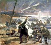
One of the most significant events in the history of the port was its defense during the Crimean War.
The British and their allies gave great importance the Far Eastern region and seaports located on the Russian Pacific coast. Therefore, coalition warships were sent here.
On August 17, 1854, an enemy military squadron appeared on the horizon in Avacha Bay. And on August 24, the battle began, during which the enemy landed troops on Nikolskaya Sopka. There was almost hand-to-hand combat, after which the enemy retreated and his ships left the bay. The courage of the port garrison became known in Crimea. After these military events, the port of Petropavlovsk no longer had the status of the main one in this region, having given the reins of power to Nikolaevsk-on-Amur.

New history of the old harbor
In 1943, the almost dying port began new life. Then the People's Commissar of the USSR Marine Fleet P. Shirshov issued order number 336, he ordered the organization of a seaport in Petropavlovsk-Kamchatsky. Such a harbor was needed for receiving, further processing and sending to the European part of the warring country a large amount of cargo shipped under Lend-Lease.
The date October 23, when the order was issued, is considered the day the port was founded. It was rebuilt in a short time by military and engineers and workers from among the local population. At the first stage, construction was carried out almost manually. But despite all the difficulties, already in 1944 a 100-ton crane was installed in the east of Niakinsky harbor. And in April of the same year, the first cargo began to be received here. The updated port played an important role in last stages war.

Modern sea gates in Kamchatka
The port underwent major reconstruction in the second half of the last century. Then they reached a capacity of more than 3 million tons. Construction Materials for settlements that were actively being built on the peninsula, equipment for military units stationed here - this is the main nature of the cargo.
Then the crisis began, and in 1994 only 480 thousand tons were processed. But despite all the economic difficulties, the harbor was preserved. Now the port processes up to a million tons of cargo per year.

In 2016, the third marine terminal in the history of the harbor was built here. For the port it is important object. This is where the port captain's office, police, border guards and customs officers will now be located.
The first sea fishing terminal has now begun operation, in which the main port services are actively involved. The harbor provides a container terminal, warehouses, receives and processes fishing vessels from all countries that come here, and provides them with almost all types of port services.
The main cargo processed here was container transportation, materials for various types of construction, cabotage cargo, cars and equipment, scrap metal and ore.
Cargoes are sent all over the world, most of them go to China and South Korea.

Plans for the future development of the port of Kamchatka
The port in Kamchatka is developing rapidly, and now there are several main directions further work on modernization:
- organizing a meeting of tourist ships. To do this, it is necessary to build a cargo and passenger terminal on Cape Signalny, and move the existing pier for bulk cargo out of the city;
- construction of a new pier for large cruise ships so that they can moor directly at the marine terminal;
- development of the Northern Sea Route - preparing the basis for its activities. This route could become an alternative to the Suez Canal;
- development of a port hub for different directions- for Canada and Northern Europe, as well as the Pacific Rim countries;
- dredging of the bottom to accommodate vessels of large displacement;
- updating the composition of vessels: it is necessary to have ice-class vessels, nuclear-powered ships, and a lighter carrier vessel.
Unforgettable sea cruises await you
Watch our new video from the unique tour "Legends of the North"
Geographic coordinates of the port: 53 degrees 2 minutes north. latitude; 158 deg. 39 minutes east. longitude
Petropavlovsk-Kamchatsky is one of the largest Pacific ports of Russia - located on the eastern coast of the Kamchatka Peninsula in Avachinskaya Bay.
The port is open for navigation during all year round. In severe winters, when the ice reaches a large thickness, ships are escorted by icebreakers.
There are two ports in Petropavlovsk-Kamchatsky - a commercial sea port and a sea fishing port. There are also berths belonging to various organizations of the city, including a ship repair yard, a thermal power plant, and an oil depot.
The berths of the commercial port and more than half of the berths of the fishing port are located in the Petropavlovskaya Bay, divided at its top into two harbors - External and Internal. The first contains the berths of the commercial port, the second - the fishing port.
The sea trade port is equipped with 11 cargo berths with a total length of 1.6 km, 4 auxiliary berths and 1 passenger berth. In addition, berth No. 13 with a length of 278 m and a depth of 13.0 m is being built. Cargo berths have the following specialization: 6 berths - for general cargo; 1 - for bulk cargo; 3 - for recycling containers; 1 berth - for transshipment of timber cargo.
To carry out cargo operations, the commercial port has more than 40 portal cranes with a lifting capacity of up to 40 tons, a large number of crawler cranes with a lifting capacity from 12.5 to 25 tons and truck cranes, 2 floating cranes with a lifting capacity from 25 to 100 tons, berth container loaders with a lifting capacity of 30.5 tons, portal loaders with a lifting capacity of 30.5 tons, bucket loaders, about 100 auto-loaders with a lifting capacity of 30.5 tons n from 1.5 to 10 tons, special vehicles for bilge work, other handling equipment.
The commercial port has indoor and outdoor warehouses with total area respectively 10.7 and 71.2 thousand sq.m.
The commercial port processes mainly coastal cargo, such as: bulk grain cargo, refrigerated cargo, metals, equipment, bagged cement, ISO and MPS containers, wheeled vehicles, round timber, lumber, mineral construction cargo, clinker, coal, some other cargo. Scrap metal, timber and mineral construction cargo are exported. Imports are dominated by grain, cement, and refrigerated cargo.
Heavy cargo weighing up to 100 tons per piece can be transshipped at a commercial port.
The port fleet of the commercial port includes about 100 vessels for various purposes, including: more than 50 cargo vessels, several passenger ships, about 15 tugs, six floating bunker ships, oil waste collectors, bilge water collectors, boats, two ferries, an Aquarius, pontoons, floating berths, a refrigerator vessel.
The berths of the commercial port are on the balance sheet of the Maritime Administration of the Port of Petropavlovsk-Kamchatsky. Transshipment of cargo on them is carried out by OJSC Petropavlovsk-Kamchatsky Sea Trade Port.
The berth front of the fishing port consists of 13 berths with a total length of more than 1.5 km. Of these, 3 (berths N 6,7 and 10) specialize in supplying fishing vessels. One shallow berth is used for berthing of port fleet vessels. The remaining berths are cargo berths.
The berths of the fishing port are located in three areas: the Inner Harbor of Petropavlovskaya Bay (berths No. 1,2,6-9, port fleet berth), Mokhovaya Bay (berths No. 10-13), Rakovaya Bay (berths No. 1,2).
To carry out cargo work in the fishing port there are 16 portal cranes with a lifting capacity from 3.2 to 30 tons, 19 jib mobile cranes, 35 trucks and 20 electric forklifts.
The fishing port has 5 indoor warehouses with a total area of 18.7 thousand square meters, a refrigerated warehouse with a capacity of 10 thousand tons and open warehouses with a total area of 32.1 thousand square meters.
Date of entry of the operator into the register: 23.11.2010
Grounds for entering the operator into the register (order number): 899
Operator name: Open Joint-Stock Company"Petropavlovsk-Kamchatsky sea trade port"
Operator location address: 683000, Kamchatka region, Petropavlovsk-Kamchatsky, pl. them. Shchedrina, 2
Start date of personal data processing: 21.07.1994
Subjects of the Russian Federation on whose territory personal data is processed: Kamchatka Krai
Purpose of processing personal data: carrying out loading and unloading activities in seaports, fulfilling contractual obligations, including under labor and civil law contracts.
Description of the measures provided for in Art. 18.1 and 19 of the Law: 03/19/2007 by order general director OJSC "PKMTP" No. 147 approved the Regulation "On working with personal data of employees of OJSC "Petropavlovsk-Kamchatsky Sea Trade Port". The premises within which the computer technology for automated processing of personal data, and premises for storing personal data on paper, are locked and guarded around the clock by the internal functional security service of the enterprise. Only specially authorized persons have the right to access personal data to the extent necessary to perform specific functions. Computers with personal data are protected by an individual password of an authorized person; additional passwords have been set for access to the internal network of a legal entity.
Categories of personal data: surname, first name, patronymic, year of birth, month of birth, date of birth, place of birth, address, marital status, social status, education, profession, income, TIN, passport details, data work book, education diploma data, insurance certificate data, military registration information, other necessary information to determine labor relations, provided for by law.
Categories of subjects whose personal data is processed: Employees (subjects) who are in labor relations with legal entity, individuals(subscriber, passenger, borrower, depositor, policyholder, customer) who are in contractual and other civil relations with a legal entity
List of actions with personal data: Collection, systematization, accumulation, storage, clarification, use, distribution (transfer), depersonalization, blocking and destruction of personal data. Processing of personal data is mixed, with transfer via internal network, is available only to strictly defined employees of a legal entity
Processing of personal data: mixed, with transmission over the internal network of a legal entity, without transmission over the Internet
Legal basis for processing personal data: clause 2 art. 5 Federal Law dated July 27, 2006 No. 152-FZ “On Personal Data”, Art. Art. 85-90 Labor Code RF, Charter of OJSC "PKMTP"
Availability of cross-border transmission: No
Database location information: Russia